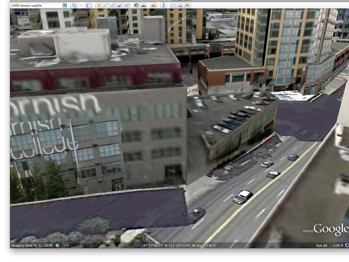
I have submitted my model of the William Volker building in Seattle, where Cornish College of the Arts' main campus is. It is a design school, and so it should have a skillful and accurate representation on GE. I've stepped up to defend our honor against this mismatched satellite photo hash-up. Look at the crap assemblages compared to what I made below:
 |
| As Cornish now appears, it needs attention. |
 |
| My submission based on photos from the web and street view. |
 |
| The William Volker Building 2011 |
 |
| Satellite photo jam up on GE |
 |
| My submitted parking deck |
 |
| existing model |
The parking deck's drive way is a mess: it's not carved out. I understand conservation of polygons, but c'mon. Make me a drive way.
 |
| proposed Model |
 |
| The parking deck in Street View |
This is a stitched image ready to be applied to my model.
I start with collected images from Street View and stitch them together. I found a few images of the full facades, but those tended not to have the detail on the bottom, like the doors and plants (see black and white photos below for an example.) I stitched them all together in Photoshop, removing cars, wires, people… trees in the wrong place…
While researching the building I found some old records, these are a pictures from the 70's or early 80's I think. Note the the top floor and pyramid are not there. Those were added in the Cornish restoration of 2003/4(?)
My image and my model are way better than what's up on GE now. The model has been in review for about a week, I'm wondering if Maybe I used too many polygons on the parapet.
|
Too many ploygons on the parapet? |